We should all get out more... The good news is that we have a lot to see in our area.
When was the last time you really stretched your legs in the great outdoors? Here are 5 Great Hikes Around Los Angeles. The fresh air and warm rays of sunshine will do wonders for your health.
By The Editors
Fri, Apr 23, 2021 01:25 PM PST
We all know the city can become a bit much. The hustle and bustle, noise, thick air and time-sensitive schedules can get overwhelming. Thankfully, there are some fantastic hikes around Los Angeles that are easily accessible by car. We’ve put together a list of 5 Great Hikes Around Los Angeles and how to get there.
1. Crags Road at Malibu Creek State Park
Round Trip: About 4.75 miles, fairly level elevation with well-groomed dirt trails.
Directions: Take PCH west to Malibu Canyon Road and turn right, heading north. Take Malibu Canyon Road north for just under 6 miles and pass through the tunnel before Piuma Road. Continue until just before the light at Mulholland Highway and turn left into Malibu Creek State Park, just past the Hindu temple. Once parked, follow the Crags Road Trail and follow the signs to the M*A*S*H set. (MAP)
The Crags Road Trail at Malibu Creek State Park is also home to the outdoor set of M*A*S*H. Boasting the famous signpost, restored ambulance and informational plaques, Crags Road Trail welcomes many fans of the long-time TV series. The park is a former 20th Century Fox studios location ranch, which owned the land from 1946 to 1971. The park was cleared out and is now very visitor friendly.
Malibu Creek State Park is a 7,000-acre wilderness refuge, complete with wild chaparral and lofty woodlands. Malibu Creek is typically tame, however, that changes if the area gets a good rain. The 15 miles of trails vary in difficulty if you’re looking for something a bit more challenging.
2. Bee Rock and Old Zoo Ruins
Round Trip: 2.4 miles, 694 ft elevation change
Directions: Take the 5 Freeway and get off at the Los Feliz Boulevard exit. Drive west on Los Feliz Boulevard and turn right at the first light, north onto Crystal Springs Road. Drive north for about 1.3 miles and turn left at the stop sign onto Fire Road. About halfway around the bend, look for the dirt trail branching off on the left side. Park in the parking lot and follow that trail for a nice round trip through the old zoo and up to Bee Rock. (Trailhead Map)
You can call this one a two-fer. Bring a picnic and eat some lunch in the ruins of the Old Los Angeles Zoo. Looming above is a porous rock that resembles a beehive, hence the name. The hike up to the Bee Rock is moderately challenging, but the views are worth it. Unfortunately, there is an ugly fence surrounding the rock, but the views are still very visible.
The old Zoo has plenty of spots to picnic, and exploring the old pens really makes you appreciate how far zoos have come in terms of the treatment of the animals. The zoo was open from 1912 to 1965, but the cages were erected in the 1930s. There are a handful of other trails to try out while you’re there, as Bee Rock is located in the east side of Griffith Park.
3. Inspiration Point Trail at Will Rogers State Park
Round Trip: 2 miles, family friendly and an easy hike
Directions: Will Rogers State Park is just off Sunset Boulevard in Santa Monica. Park right at the visitor’s center (parking fee: $12, seniors $11), and your hike begins just behind the main ranch house. (Map)
Will Rogers Park is the former estate of prominent and popular public figure Will Rogers in the 1930s. Following the unfortunate plane crash that took his life, Will’s widow Betty donated the ranch to California State Parks in 1944, and it became a state historic park. The ranch and surrounding attractions are impressive enough, and families can enjoy the sprawling front lawn for a picnic.
Inspiration Point Trail is a nice, easy loop with a must-see viewpoint about halfway through. Inspiration Point bestows views of Los Angeles and the Santa Monica mountains. Follow Backbone Trail as it morphs into Inspiration Point Trail and back down to the main ranch area.
4. Cooper Canyon Falls via Burkhart Trail
Round Trip: 2.5 miles, though the climb down to the Falls is tricky.
Directions: The trailhead is off Highway 2 in the Angeles National Forest, about 6 miles west of Highway 39. The beginning of the Burkhart Trail is at the back end of the Buckhorn Campground. Follow the Burkhart Trail for about 1.2 miles until you meet the junction with the Pacific Crest Trail. The Falls are to your right a few hundred yards. (Map)
Cooper Canyon Falls is an impressive sight, especially if you visit while the snow melts in April/May. The Burkhart Trail isn’t a loop, but rather a ‘there-and-back-again’. The trail begins on a descent, so save some energy for the return ascent. Redwoods tower along the trail that’s usually pretty quiet and shady.
About 1.2 miles along on the Burkhart Trail, you run into the PCT. Once you hit this crossroads, you know you’re close to the falls. It’s a tricky scramble down to the falls, but there’s a rope that helps getting down and climbing up. Just make sure you save some strength; the return hike is uphill! If you’re feeling up for it, there’s also a 6-mile loop to try out.
5. History Trail at Vasquez Rocks
Round Trip: 3 miles with plenty of easy trails.
Directions: Take Golden State Freeway (I-5) north to Antelope Valley Freeway (CA14). From there, head north on CA14 and exit on Agua Dulce Canyon Rd., turn left and drive through the sharp right bend and look for Vasquez Rocks signs. The park is off to your right. (Map)
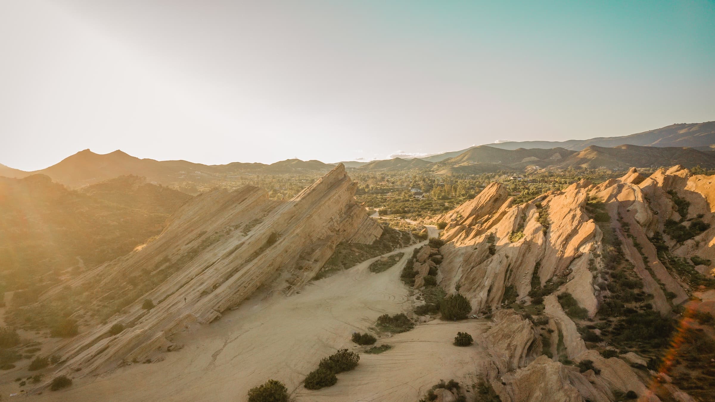
Vasquez Rocks Natural Area boasts some truly other-worldly rock formations that have been featured in many TV and movie appearances. These rock formations reach up to 150 feet into the sky and transport you to a Martian landscape. That’s what filmmakers must’ve thought too as this led to its most famous appearance in Star Trek Season 1 episode 18 “Arena”, where Captain Kirk battles the Gorn.
The park’s namesake, Tiburcio Vásquez, used the Rocks as one of his hideouts in the mid-1800’s. The History Trail is also part of the Pacific Crest Trail, which stretches from Canada to Mexico. Vasquez Rocks is a significant prehistoric site for the Shoshone and Tataviam peoples and was added to the National Register of Historic Places in 1972. There is very little shade if you visit, so bring a hat, sunglasses, sunscreen and plenty of water!
